ROCHESTER, Minn. (KTTC) – We saw more beautiful spring weather across SE Minn. and NE Iowa on Thursday. Even more warmth is ahead for Friday as many towns in our area could see record warmth as afternoon highs climb into the 70s.

Record high temps possible Friday(KTTC)
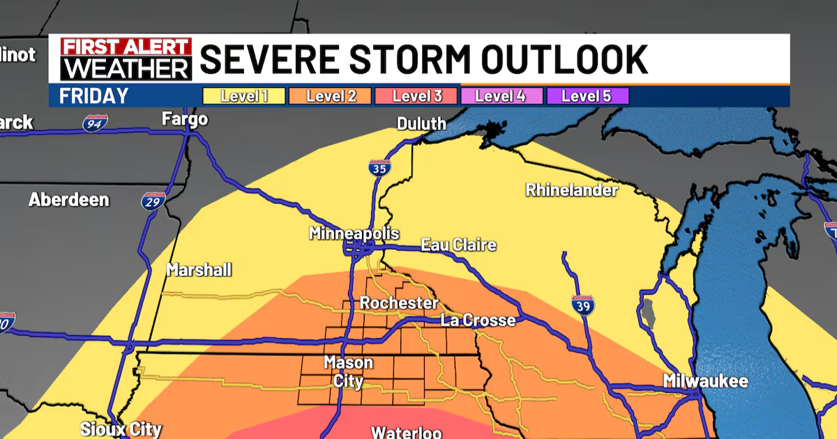
In addition to the record warmth we are tracking for the daytime Friday, we are tracking the threat of strong to severe storms Friday evening. Friday will be a First Alert Day for our area. SE Minn. and NE Iowa are currently under a level 2/5 risk for severe weather.

Severe storm outlook – Friday(KTTC)

The current timing brings thunderstorms into our southwest edge near Mason City, IA around 6/7 pm, along the Hwy 52 corridor around 8/9 pm, and the Mississippi River after 10 pm.

Storm timing(KTTC)
I do think our severe threat is conditional for the local area as some factors may limit our severe potential tomorrow. However, should we manage to see strong to severe storms initiate, then strong to damaging wind will become our primary threat across SE Minn. and NE Iowa. We also cannot rule out the potential for hail or an isolated spin-up tornado.

Storm threats(KTTC)

Colder air is expected to wrap in on the backside of this system, which means we could see periodic rain and snow showers throughout the day on Saturday. Temperatures will be more seasonal in the 30s this weekend before rebounding to the 50s and 60s early next week.
The middle of next week looks more active with another system expected to move through our area. Tuesday night into Wednesday could feature rain and snow showers with temperatures in the 30s.

10-day forecast(KTTC)
Find stories like this and more, in our apps.

Copyright 2025 KTTC. All rights reserved.